Elevation
Geodesy Transform provides SRTM (Shuttle Radar Topography Mission) elevation data so while entering coordinates you can get calculated normal height (Hnorm), ellipsoidal height (Hell) and geoid anomaly (A) automatically.
Click on the map to get coordinates with already prefilled heights and geoid anomaly.
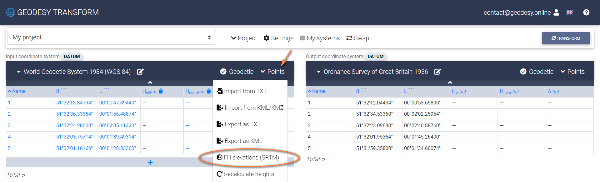
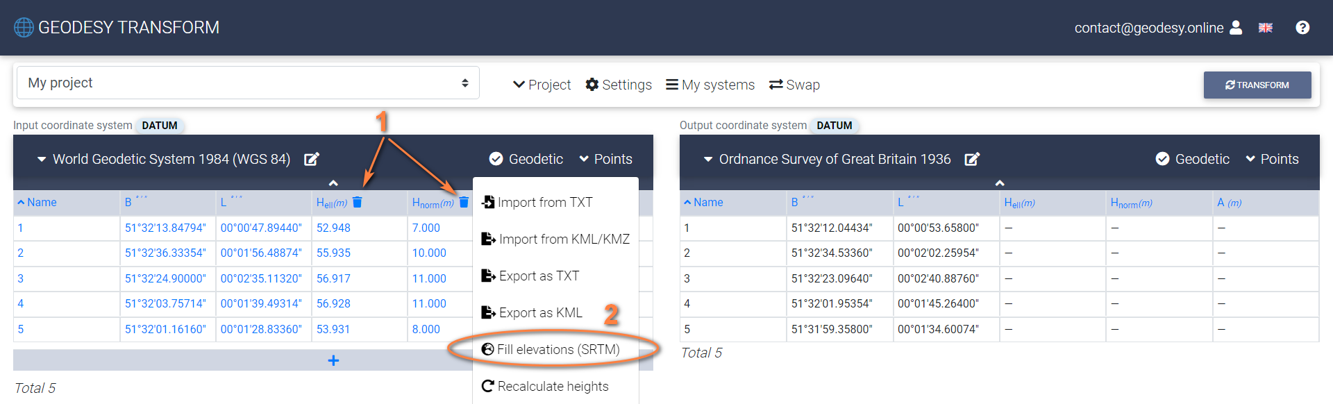
If coordinates entered manually, click "Fill elevations (SRTM)" under the Points menu to autofill missing Hnorm and calculate Hell, A values.
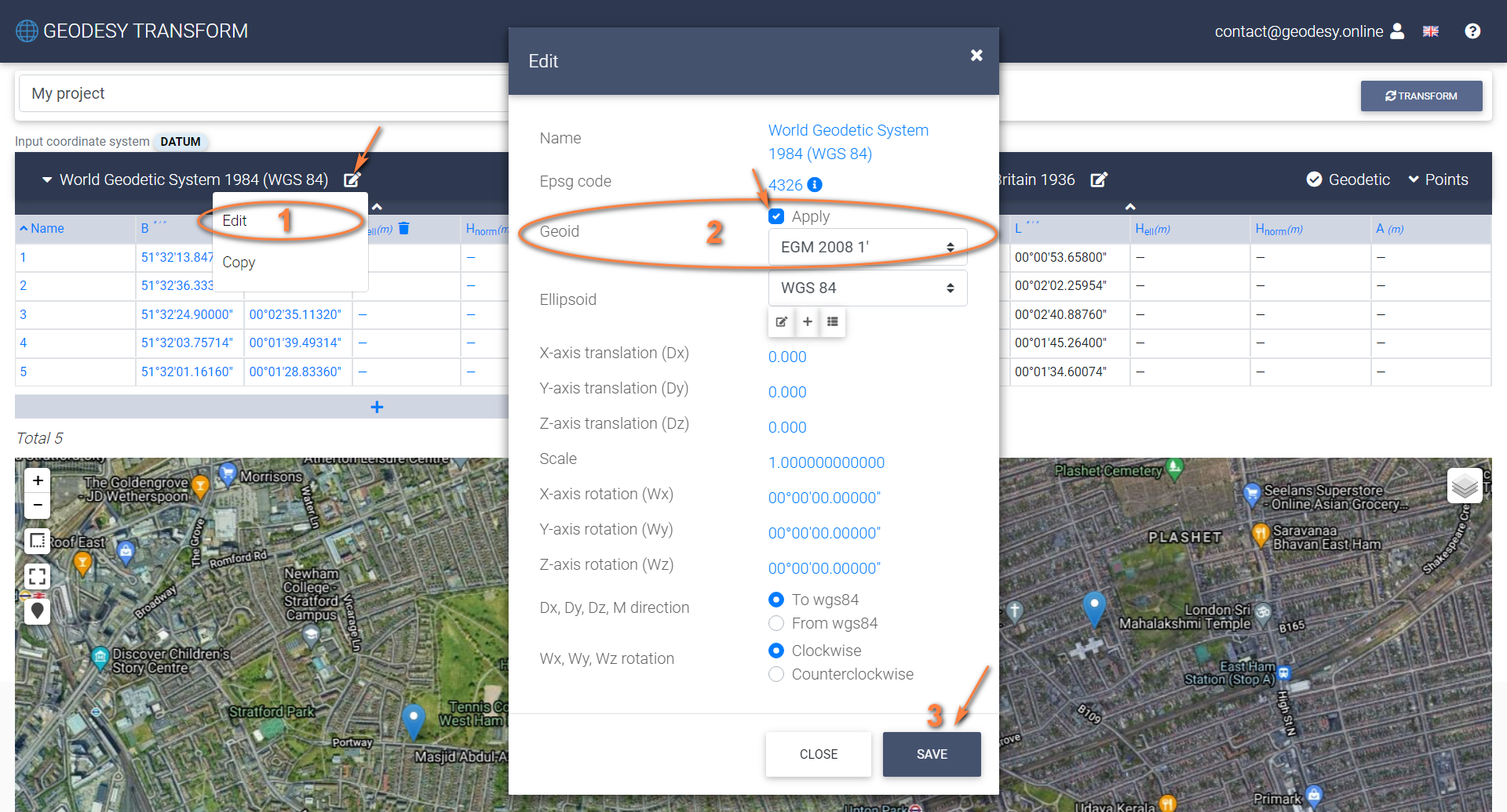
Ellipsoidal height and geoid anomaly are calculated based on the selected Geoid in the coordinate system settings. If Geoid is not specified, then Hell and A are not calculated.
In order to reset the heights, clear column values and click "Fill elevations (SRTM)" under the Points menu.
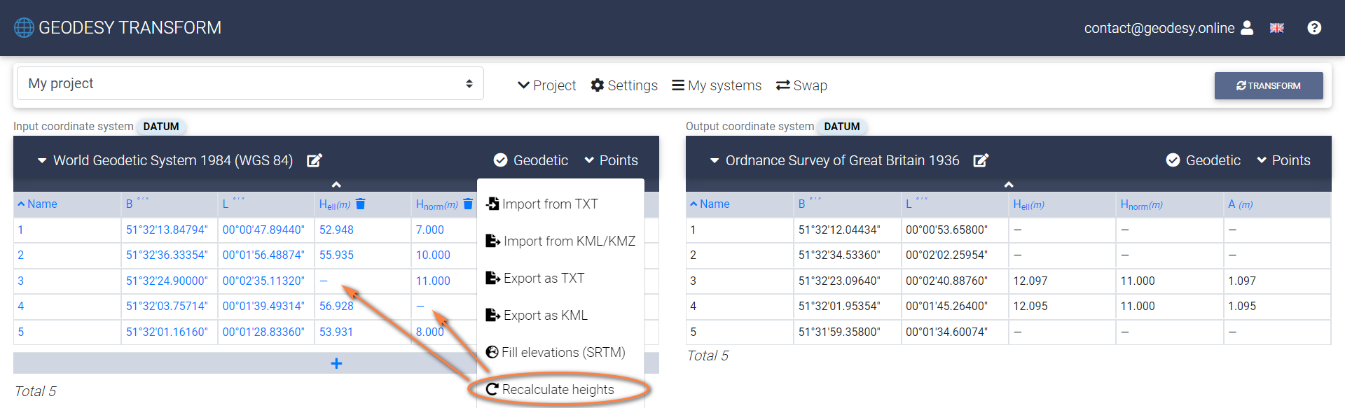
Use "Recalculate heights" to calculate ellipsoidal (Hell) or normal (Hnorm) heights if one of them is missed. "Recalculate heights" doesn’t use SRTM and calculate missing H (ellipsoidal or normal) based on the one that is available.