Calibration
Geodesy Transform supports calibration and establishing communication parameters for Datum, Grid (Transverse Mercator, Lambert Conformal Conic) and Local coordinate systems.
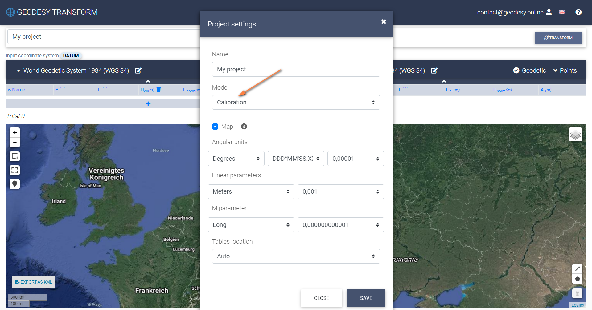
1. Open Geodesy Transform. Turn on Calibration Mode in project settings
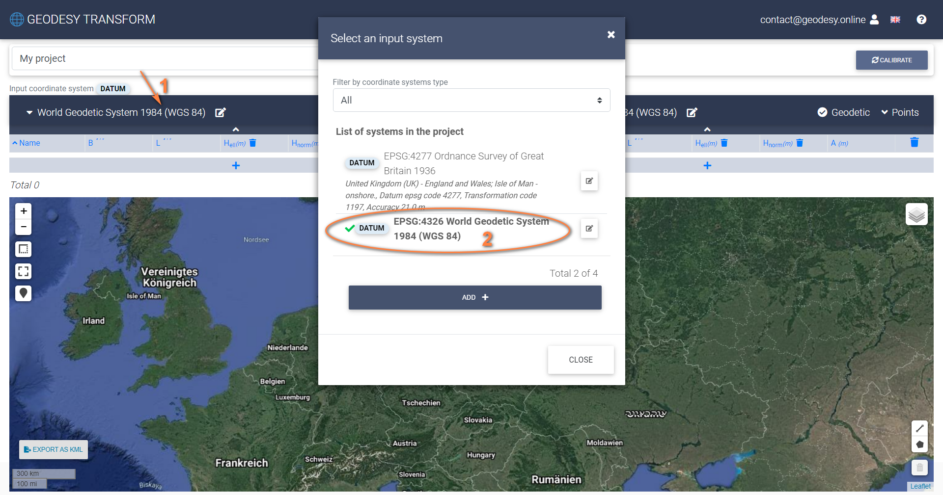
3. Choose INPUT system on the left
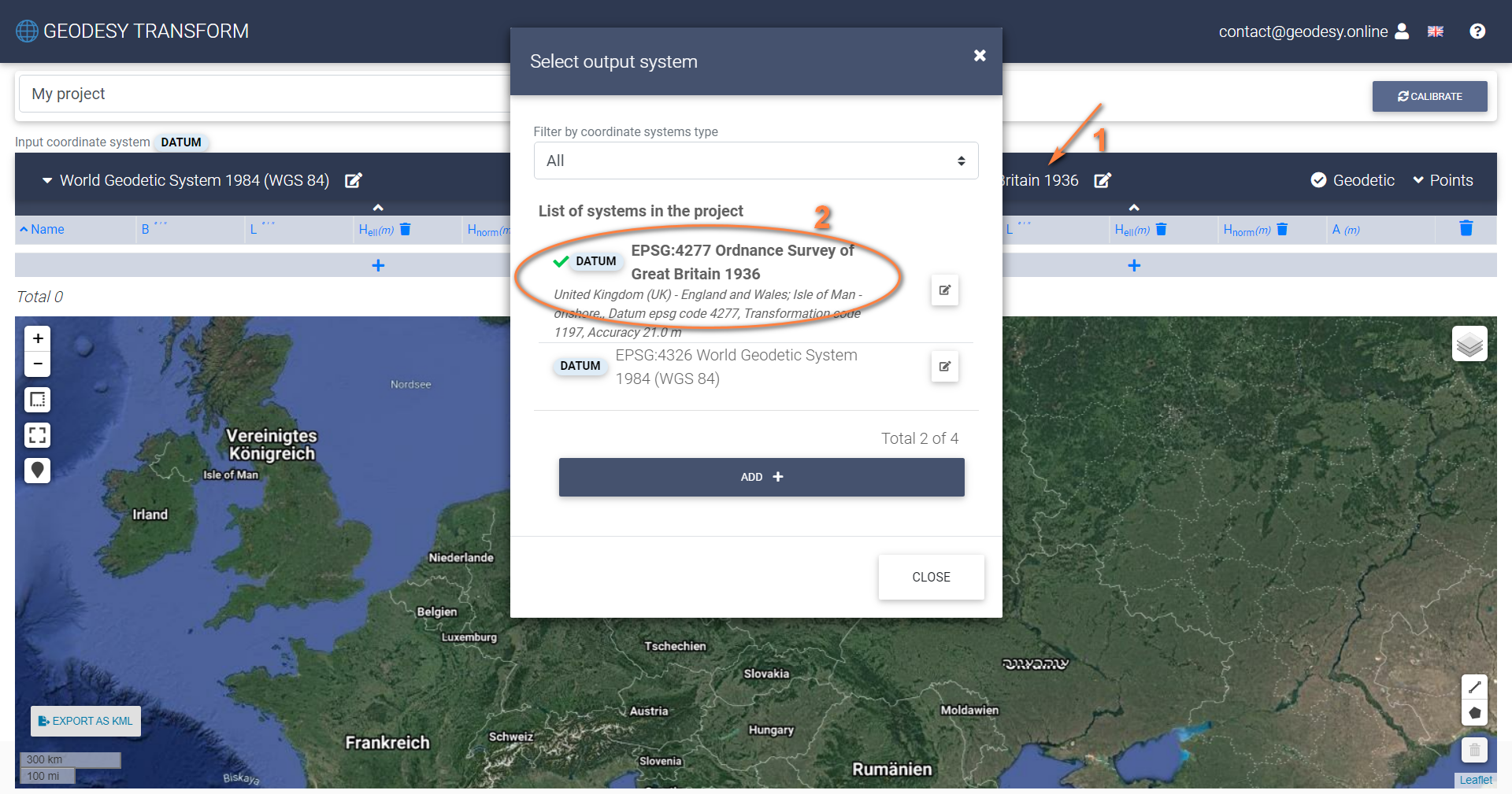
4. Choose OUTPUT system on the right
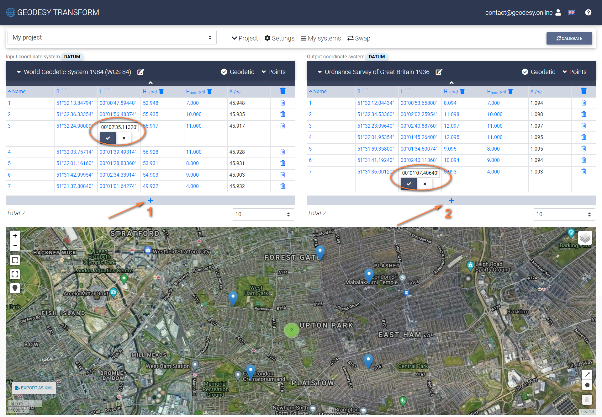
5. Enter coordinates in both tables and press “Calibrate” button
6. Save calculated parameters
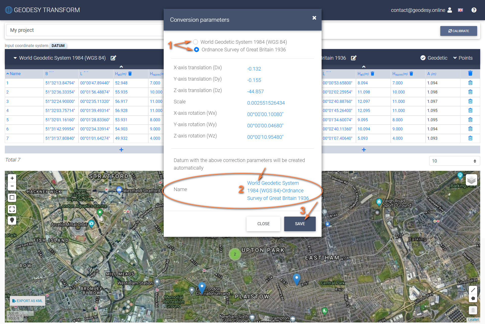
While saving parameters, a new coordinate system is created. The type of new system and the set of parameters might be different depending on the selected type of INPUT and OUTPUT coordinate systems. Below is the example for Datum-Datum calibration.
7. That’s it. Switch back to Transformation Mode in project settings and use a new coordinate system to transform points.
Supported calibration combinations:
- Datum with Datum
- Datum with Transverse Mercator
- Datum with Lambert Conformal Conic
- Transverse Mercator with Datum
- Transverse Mercator with Local
- Transverse Mercator with Lambert Conformal Conic
- Lambert Conformal Conic with Datum
- Lambert Conformal Conic to Transverse Mercator
- Lambert Conformal Conic with Local
- Local with Local
- Local with Transverse Mercator
- Local with Lambert Conformal Conic